10 Illustration maps 1383786

10 Illustration maps 1383786

10 Illustration maps 1383786
EPS PNG | 26 MB RAR

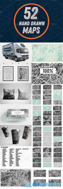
Hand drawn map of France, Holland, Italy, Spain, Britain, Ireland's, Iceland, USA, China and Australia. Maps contain the main attractions of the countries and the main names of cities. This set is perfect for designing posters for tourist booklets, emblems for T-shirts, bags, cups, label, sticker and others.
Read more

Antique Maps Vol.I - Standard Size 704223

 Antique Maps Vol.I - Standard Size  704223

The long promised standard edition of the antique maps is finally here! And it comes with a special bonus - a FREE vintage map of the London tube available only in this pack. Grab it now!

The maps in the standard edition come as 8.5x11inch high resolution (300ppi) JPGs and TIFFs. Zoom in and discover the little details! Perfect for print projects such as calendars, posters, book covers, invitations and more.

The maps were scanned from an original set of encyclopedias published in the 1900's. Each map had been folded in two and attached to a connecting piece, so expect to see some authentic paper creases. A few spots and smudges here and there give the maps just the right amount of vintage character.
Read more

CodeCanyon - Zhen Distribution Maps (Update: 23 January 14) - 5028026

CodeCanyon - Zhen Distribution Maps (Update: 23 January 14) - 5028026


CodeCanyon - Zhen Distribution Maps (Update: 23 January 14) - 5028026

Need a distribution/mapping system for your business? Need to track distribution metrics and problems on a map backed by a database?
Zhen Distribution Maps is the solution for your needs! Zhen Maps can run on any shared host with PHP and MySQL installed, and provides a great-looking and easy-to-use UX that allows you to easily track your distribution in a web-based application.
Best of all, this is self-hosted, so you can install it once on your servers and have peace of mind that you have full control of the product and usage!
Read more